India Identifies 27 Places In Arunachal By Standard Names On Official Map, Pg9
India formally identifies 27 places in Arunachal Pradesh on its official map, countering China's renaming attempts and asserting territorial integrity amidst border disputes.
Practice MCQs
833 Students attempted
Key Highlights:
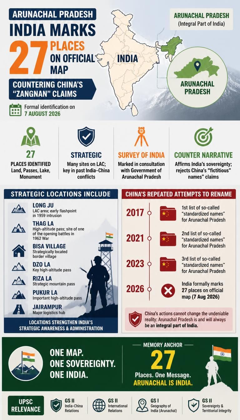
- India formally identified 27 places and geographical features in Arunachal Pradesh on its official map.
- This action by India is a direct response to China's repeated attempts to rename locations in the state.
- The identification on the Survey of India map aims to ensure accurate recognition and public awareness of these places.
- Key locations marked include Long Ju, Maja, Thag La, Dzo La, Riza La, Fukur La, and Jairampur, many of which have historical significance in the Sino-Indian Border Dispute.
Arunachal Pradesh.jpg
Detailed Insights:
- New Delhi consistently rejects China's renaming efforts, asserting that such moves are "vain and preposterous" and do not alter the reality of Arunachal Pradesh as an integral part of India.
- Long Ju, located along the Line of Actual Control (LAC), was an early flashpoint between India and China in 1959.
- Thag La is a strategically important high-altitude pass where one of the opening battles of the 1962 Sino-Indian War took place.
- Jairampur in Changlang district is a crucial logistics hub supporting the movement of security forces towards eastern Arunachal and the Myanmar frontier.
- The Survey of India, India's principal mapping agency, functions under the Department of Science and Technology and is responsible for mapping and surveying the country.
- China claims Arunachal Pradesh as "South Tibet" and has historically rejected the McMahon Line, which India considers the boundary.
- India views China's attempts to assign "fictitious names" as creating "baseless narratives" that could negatively impact bilateral ties.
Key Concepts Involved:
- Line of Actual Control (LAC): A notional demarcation line separating Indian-controlled territory from Chinese-controlled territory, which is not mutually agreed upon or demarcated on the ground.
- Sino-Indian Border Dispute: An ongoing territorial dispute between India and China primarily over Aksai Chin in the western sector and Arunachal Pradesh in the eastern sector.
- Survey of India: The national mapping and surveying organization of India, established in 1767, functioning under the Department of Science and Technology.

SuperKalam is your personal mentor for UPSC preparation, guiding you at every step of the exam journey.
Download the App


STUDY RESOURCES
CONTACT US
ⓒ Snapstack Technologies Private Limited